ABOUT
SENSORBITE develops a geospatial intelligence platform that integrates geospatial data to generate detailed, intuitive maps and reports. By employing advanced algorithms and AI-driven analytics, the platform transforms complex remote sensing data into clear, actionable insights
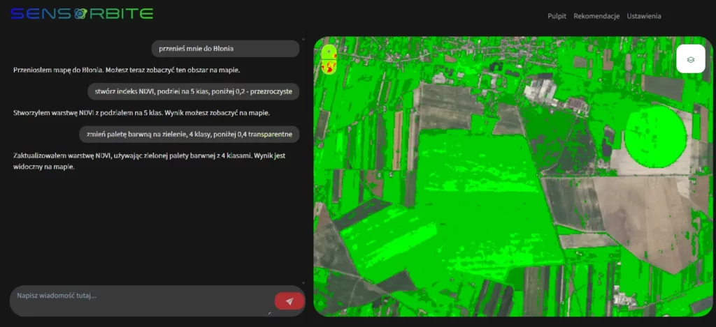
Users can interact with SENSORBITE using plain language queries, enabling them to quickly access information on crop health, environmental changes, water usage, and other critical parameters. The system updates with the latest data, ensuring that its outputs remain both relevant and precise. Using a user-friendly interface, allows users to easily extract needed information, eliminating the need for specialized technical expertise.
Designed for a wide range of applications, SENSORBITE simplifies the monitoring of Earth’s dynamic processes, empowering stakeholders to make informed decisions and optimize resource management for sustainable outcomes. This approach to geospatial analysis enhances the proper use of Earth Observation in agriculture, forestry, environmental protection and sustainable urban planning.